


Open street mapping to ensure speedy relief for landslide victims
THIRUVANANTHAPURAM: Getting a blueprint of the topography of a region, detailing its characteristics and extent of damage, would be the most essential tool for rescue and relief operations in any natural calamity.
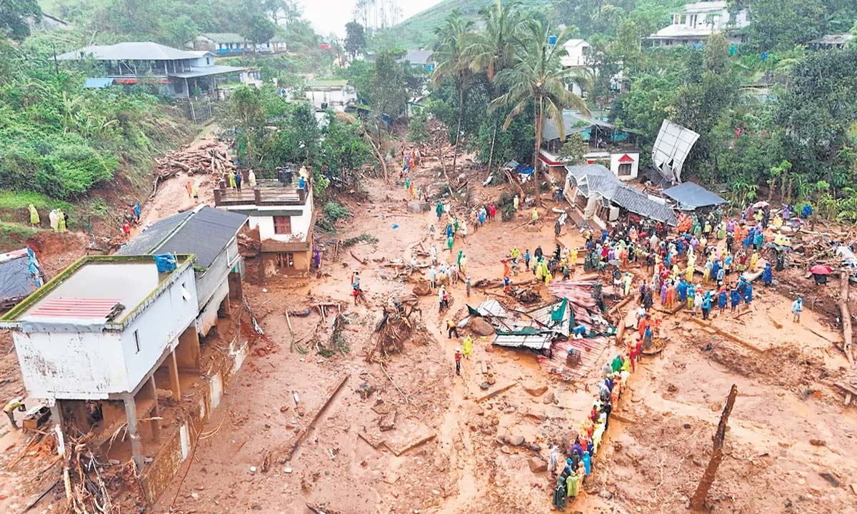
Taking a cue from past natural disasters, a host of silent warriors are up and about, contributing in a unique way to help both authorities and victims to effectively deal with the twin landslides in Wayanad. And what are they weaponed with? Maps!
A host of mapping volunteers who are part of the open street mapping community from across the globe are busy drawing up data to help the authorities ensure speedy relief to the victims. Going by the open street mapping data, about 60 hectares of human inhabited region, including the river basin from Mundakkai to Chooralmala, bore the brunt of the twin landslides.
Open street mapping is done by a community of mapping enthusiasts who have effectively come together to gather and disseminate mapping data. It’s a project similar to Wikipedia, where each mapper edits and adds data points to come up with clear maps.
Mapping of the Kabini River basin with a special focus on flood-affected and landslide-prone regions, a project kick-started in 2023, was completed in 2024. The project, which covered basic physiological and terrain data of the region, was carried out with the help of about 60 volunteers. As part of this, buildings, bridges, rivers and streams and some areas of roads were mapped.
Soon after the twin landslides at Chooralmala and Mundakkai, the community started mapping the Meppadi region. Currently about 30 volunteers – including about 15 from outside Kerala – are active in the initiative. Once the data is added, then a participatory approach will be made with the help of residents.
“This project is specifically looking at Meppadi. Going by the initial data, about 500 buildings in addition to four bridges – two each in Chooralmala and Mundakai – were affected. As per current assessment, the mapping will be completed in two days. The project is done by the open street mapping Kerala community along with Ferns Mananthawady,” said P Rajaneesh of Open Data Kerala Community.
The contribution of open street mapping had come to the fore during the 2018 flood, when about 2,200 mapping volunteers from across the globe added about close to 4 lakh data points to the map, thereby supporting rescue and relief work.