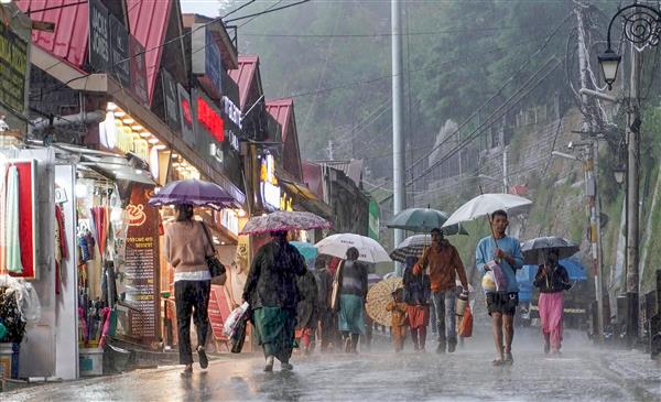
Chandigarh: Heavy rain lashed parts of northwest and south India on Monday, leading to anguish for some and relief for others, particularly farmers of Tamil Nadu awaiting their share to replenish depleting reservoirs and nourish fields.
According to the IMD, the wet spell is “likely to continue over northwest till October 17, along with heavy to very heavy rainfall, over Tamil Nadu and Kerala during the next 24 hours followed by a reduction thereafter.”
The reason for the intense meteorological event in the northwest, according to the weather office, is the convergence of two western disturbances. Along with it, moisture feed from the Arabian Sea to northwest in lower tropospheric levels added to the intensity.
So far as the south peninsula is concerned, a cyclonic circulation over coastal Tamil Nadu, another one over Lakshadweep area and adjoining Southeast Arabian Sea and Kerala coast are among the reasons for the spell of rains.
Meanwhile, according to the IMD, a low pressure area is likely to develop over southeast and adjoining east-central Arabian Sea during next 48 hours. It is likely to move further west-northwestwards and intensify into a depression over central Arabian Sea around October 21.
Temperatures to drop in Northwest
Many parts of Punjab, Haryana and Chandigarh witnessed heavy rain this morning, bringing down the temperature. Upper reaches of adjoining Himachal Pradesh also witnessed snow and rain.
Heavy rain at this time of the year, when the southwest monsoon has withdrawn from the region, added to the worries of farmers with crops lying in the open. Light to moderate rain accompanied by isolated thunderstorm and lightning was witnessed at many places in the region today.
The IMD said the situation is expected to continue on October 17 and reduce thereafter.
As the systems recede, northwest can expect a drop in temperatures, say experts, adding that mercury may register a fall of two to four degrees over the next couple of days, thereby marking a shift in weather conditions in the north
South India and NE monsoon
So far as the South Peninsula is concerned, it is awaiting its share of northeast monsoon rain which appears to have been delayed due to a lingering southwest monsoon.
According to the IMD, conditions are becoming favourable for further withdrawal of SW monsoon from remaining parts of Bihar, sub-Himalayan West Bengal and Sikkim, entire northeast, some more parts of Andhra Pradesh, remaining parts of Telangana and some more parts of north and central Bay of Bengal over the next 48 hours.
A lingering SW monsoon, according to meteorologists, is one of the factors responsible for the expected delay in the arrival of northeast monsoon this year.
The normal date of setting in of easterlies over the southeastern peninsular India is October 14.
The normal date of onset of NE monsoon over Coastal Tamil Nadu and south coastal AP is October 20.
This year, NE monsoon is expected to set in over Tamil Nadu between October 23 and 25.
Meanwhile, light to moderate rain at many places with isolated heavy rain accompanied by thunderstorm and lightning is expected over Tamil Nadu, Puducherry and Karaikal, Kerala and Mahe tomorrow as well.
As per IMD, cyclonic circulations over coastal Tamil Nadu and neighbourhood as well as over the Lakshadweep area, adjoining the Southeast Arabian Sea and the Kerala coast are the reasons behind the downpour in the state. Yesterday the IMD had issued an orange alert for some districts of Kerala.
Tamil Nadu has been waiting for NE monsoon to replenish its depleting reservoirs and feed the fields.
Northeast monsoon
Northeast monsoon rain is essential for most southern states facing rainfall deficits.
However, till around October 15, Tamil Nadu registered a shortfall of 25% and Karnataka 53% deficit.
In contrast, Kerala registered a surplus this month.
Notably, South Asia experiences two monsoons—Southwest monsoon or summer monsoon during June to September and Northeast monsoon or winter monsoon during October to December.
While June to September rain is responsible for a major portion of annual rainfall over India, the rain received during the NE monsoon season is important for south peninsula, Sri Lanka and Maldives.
During the SW monsoon, the southeastern parts of India remain in the rain-shadow region and receive moderate rain.
“The Indian southwest monsoon (SWM) season of June to September is the chief rainy season for India and about 75% of the country’s annual rainfall is realised during this season.
“Subsequent to the withdrawal of SWM, the northeast monsoon (NEM), a small scale monsoon confined to parts of southern peninsular India comprising of the meteorological sub-divisions of Tamil Nadu, Puducherry and Karaikal, Kerala and Mahe, Coastal Andhra Pradesh and Yanam, Rayalaseema and South Interior Karnataka occurs.
“For the subdivision of TN, the normal SWM seasonal rainfall realised is only about 35% (342.0 mm) of its annual rainfall (943.7 mm) as this subdivision comes under the rain-shadow region during the SWM.
“The northeast monsoon (NEM) season of October to December (OND) is the chief rainy season for this subdivision with 48% (447.4 mm) of its annual rainfall realised during this season and hence its performance is a key factor for this regional agricultural activities,” says the IMD.


